Global geophysical company TGS has initiated its Pelotas Norte Phase I 3D multi-client seismic survey. This significant project lies offshore southern Brazil. The survey aims to enhance exploration imaging efforts in the region.
Survey Details and Scope
The Pelotas Norte Phase I survey spans a vast 14,800 square kilometers. It primarily targets unallocated acreage. This strategic timing precedes upcoming Brazilian bid rounds. TGS intends to provide crucial data to potential bidders.
Targeting Unallocated Acreage
Exploration imaging is a key objective for the project. The survey will deliver high-resolution data. This information will support future oil and gas exploration. It helps companies evaluate prospects more effectively.
Technological Implementation
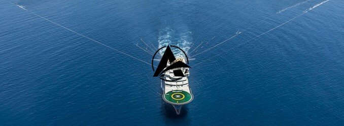
A specialized Ramform Titan-class vessel is carrying out the data acquisition. This vessel employs advanced GeoStreamer® technology. GeoStreamer® systems provide superior data quality. They capture a broader spectrum of seismic frequencies.
Project Timeline and Future Outlook
Operations for the Pelotas Norte Phase I survey began recently. TGS expects data acquisition to continue through the third quarter of 2026. The company anticipates delivering valuable insights. This long-term project underscores TGS’s commitment to Brazil’s energy sector.
TGS’s Pelotas Norte Phase I survey represents a significant investment. It will boost understanding of Brazil’s offshore potential. The project provides foundational data for future exploration success. It positions TGS as a key partner in regional development.


Leave a Comment